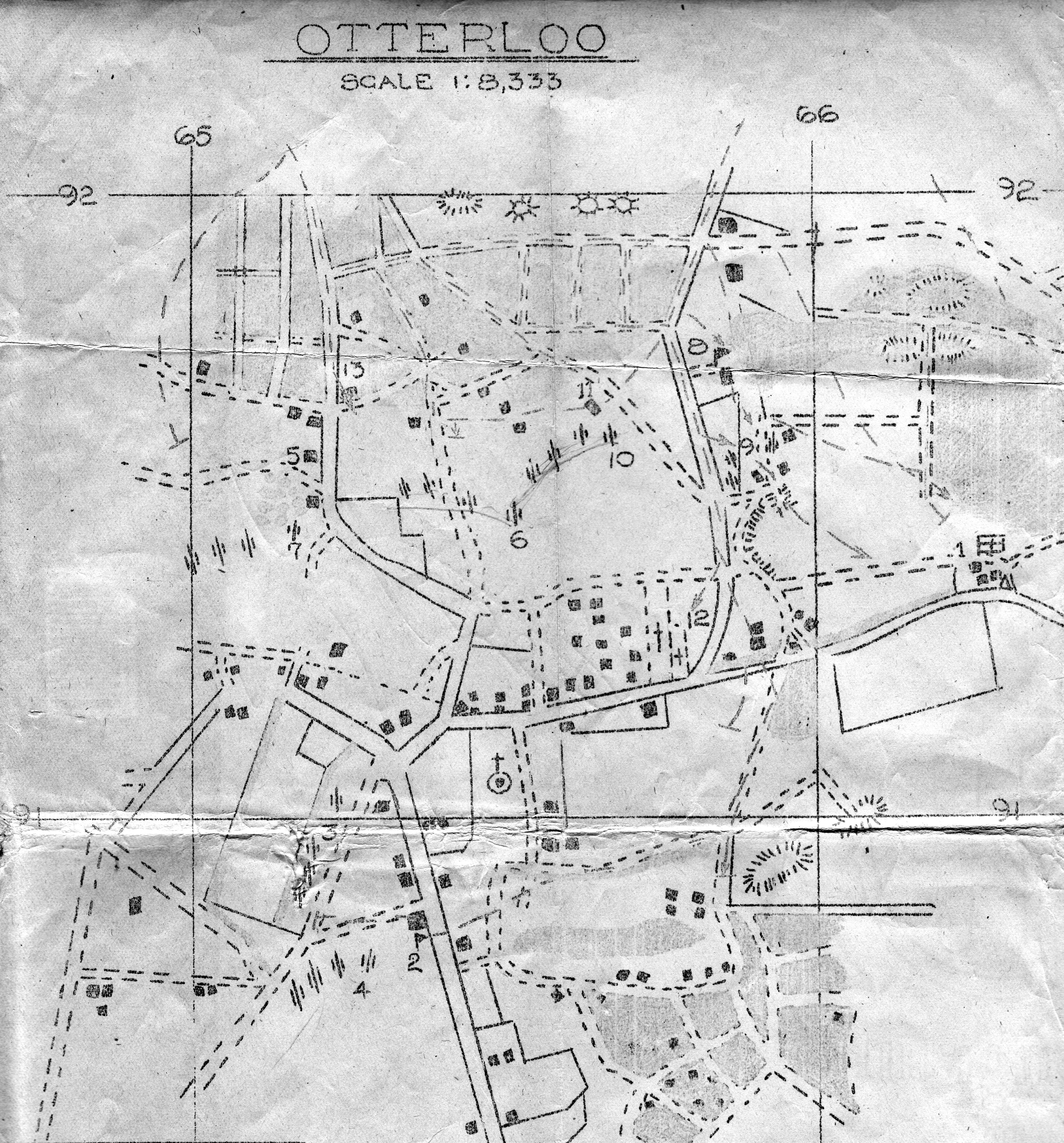
The distance between grid lines, between 65
and 66 east or between 91 and 92 north for
example, is 1000 metres or 1093.6 yards.
The grid lines appear to be located about
60 metres southwest of their actual positions.
and 66 east or between 91 and 92 north for
example, is 1000 metres or 1093.6 yards.
The grid lines appear to be located about
60 metres southwest of their actual positions.
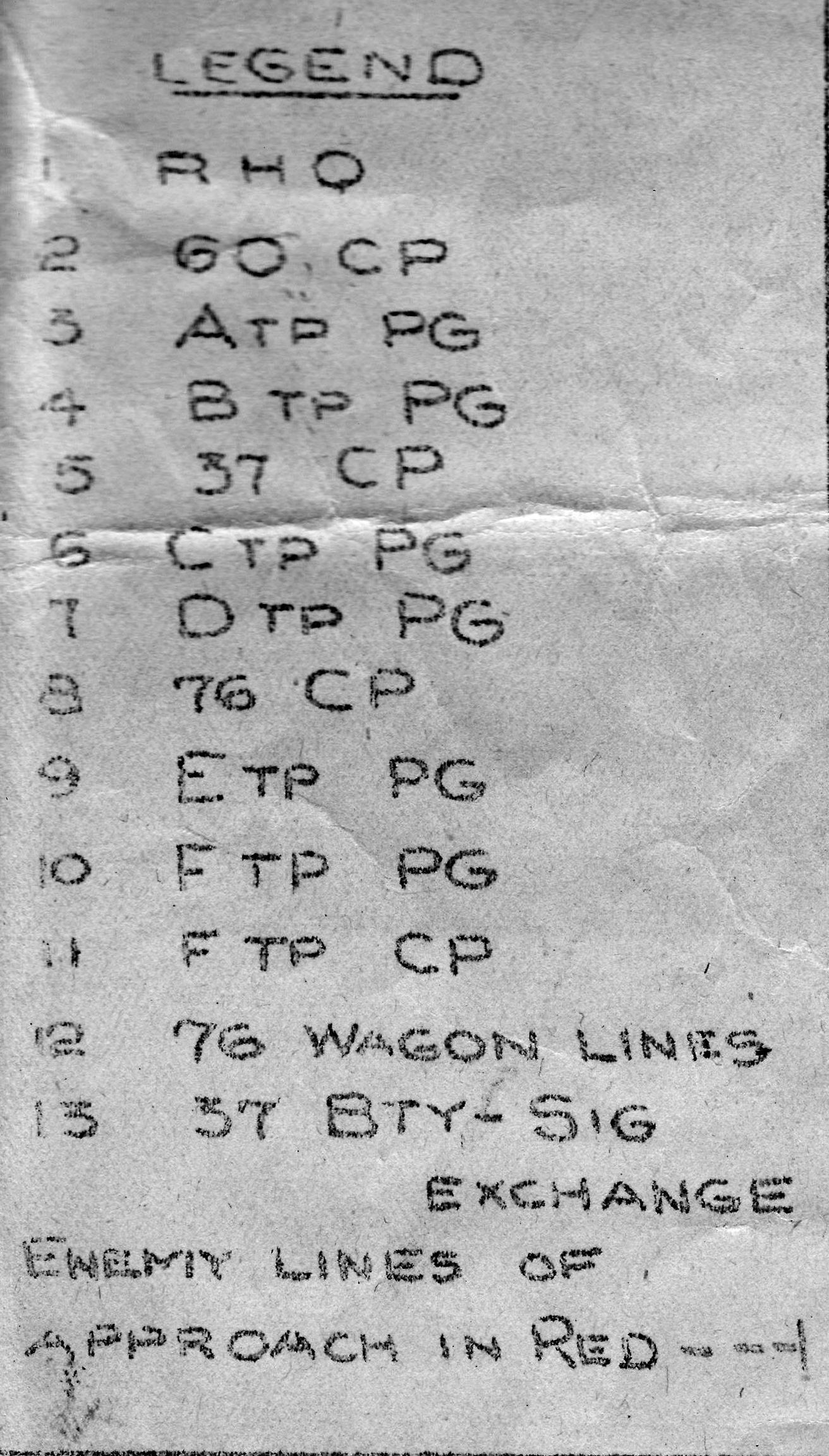
Expanded Legend for
Otterloo Map
Otterloo Map
- 1. Regimental Headquarters, 17th Field Regiment
-
60th Battery
- 2. 60th Battery command post
- 3. Able Troop pivot gun (right-most gun)
- 4. Baker Troop pivot gun (right-most gun)
-
37th Battery
- 5. 37th Battery command post
- 6. Charlie Troop pivot gun (right-most gun)
- 7. Dog Troop pivot gun (right-most gun)
-
76th Battery
- 8. 76th Battery command post
- 9. Easy Troop pivot gun (right-most gun)
- 10. Fox Troop pivot gun (right-most gun)
- 11. Fox Troop command post
-
12.
76th Battery wagon lines
(Fox Troop only)
- 13. 37th Battery signal exchange
-
Pausing the mouse over a number on the
map will show a box containing the
legend information. -
Although a few red flecks still appear
on the original map, more than 70 years
of fading prevent any reconstruction
of the red lines.